The Challenges of Geodetic Surveys in Rugged Australian Terrain
Table Of Contents
Safety Concerns for Survey Teams
Navigating through rugged landscapes presents significant risks for survey teams. Uneven ground, steep inclines, and potential wildlife encounters can all pose serious hazards. These factors demand careful planning and risk assessment to ensure the safety of team members. Adequate training in first aid and knowledge of the terrain are essential prerequisites.
Another critical consideration is the communication infrastructure in remote areas. Limited mobile coverage can hinder quick access to emergency services in case of accidents. Implementing reliable communication systems is vital for maintaining contact between team members and coordinating responses in emergencies. Regular safety briefings and drills can also prepare teams for unexpected incidents while working in challenging environments.
Ensuring Team Safety in Isolated Areas
Safety is paramount when survey teams operate in remote locations. Factors such as unpredictable weather conditions, rugged terrain, and the proximity to wildlife create unique risks. Teams often rely on thorough pre-survey planning that includes identifying potential hazards and establishing clear communication protocols. It is essential to equip members with appropriate safety gear and provide training for emergency situations. Ensuring that all team members are familiar with the area can mitigate risks and enhance readiness for any challenges that may arise.
Another critical aspect of team safety involves logistical support. Remote work often means limited access to medical facilities, so having first aid supplies and a trained medic on-site can be lifesaving. Establishing a check-in system allows teams to report their status regularly. Utilising GPS tracking can also enhance safety, allowing team leaders to monitor locations. Additionally, a robust contingency plan for unexpected events ensures that teams can respond swiftly to emergencies while maintaining a focus on their objectives.
Data Collection Techniques
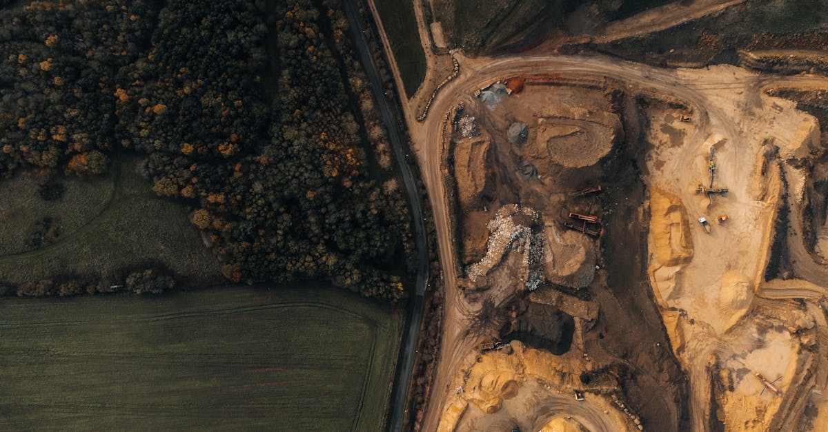
When conducting geodetic surveys in rugged Australian terrain, teams often rely on a combination of traditional and modern data collection techniques. GNSS (Global Navigation Satellite System) technology plays a critical role in obtaining precise measurements. Surveyors utilise portable GNSS receivers to gather real-time positioning data, which is essential for mapping challenging landscapes. The accuracy of these devices can be affected by factors such as signal obstruction from natural features, necessitating careful site selection for optimal results.
In addition to GNSS, teams may employ total stations and digital levels for efficient data capture. Total stations offer the advantage of measuring angles and distances simultaneously, generating comprehensive survey data with ease. Complementing these devices, digital levels ensure high precision in elevation measurements, particularly important in uneven terrains. Combining these methods allows surveyors to triangulate data points effectively, even when navigating through difficult environmental conditions. This multifaceted approach ultimately enhances the reliability and accuracy of geodetic surveys in Australia's complex landscapes.
Methods for Gathering Precise Data
Accurate data collection in rugged Australian terrain requires a combination of traditional methods and modern innovations. One popular technique involves using Global Navigation Satellite Systems (GNSS) for positioning. When set up correctly, GNSS can provide high-precision location data, which is crucial in an environment where topographical variations can obfuscate traditional survey markers. Additionally, ground-based methods such as total stations remain relevant, particularly in areas with poor satellite visibility. These tools allow surveyors to triangulate positions through measured angles and distances, ensuring reliable data despite the challenging landscape.
Incorporating terrestrial laser scanning offers another layer of detail to surveys. This method captures dense point clouds that reflect the physical characteristics of the terrain and surrounding features. The high density of data allows for meticulous 3D modelling and analysis, making it easier to plan and execute projects in difficult locations. Drones equipped with photogrammetric capabilities also enhance data collection efforts, covering vast areas quickly while providing a bird's-eye view. Combining these technologies facilitates the comprehensive gathering of precise data, which is essential for effective planning and decision-making in the field.
Technological Advancements in Surveying
The evolution of surveying technology has significantly changed the landscape of geodetic surveys, particularly in tough Australian terrains. GPS systems provide high-precision measurements that are indispensable for accurately mapping challenging environments. Drones equipped with advanced imaging sensors have emerged as vital tools, allowing surveyors to capture large areas quickly while minimising risk to personnel. These aerial capabilities enable the collection of data from otherwise inaccessible locations, streamlining the surveying process.
Remote sensing technologies also contribute to improving data accuracy and efficiency. LiDAR (Light Detection and Ranging) systems, for instance, allow for the rapid acquisition of topographic data, even in dense vegetation. This technology delivers high-resolution models of the terrain, providing surveyors with the necessary information for effective planning and decision-making. Such advancements not only enhance the quality of survey data but also ensure that teams can operate more efficiently in rugged and isolated locations.
Innovations That Overcome Terrain Challenges
Recent advancements in surveying technology have the potential to significantly enhance data accuracy in rugged Australian landscapes. Drones equipped with high-resolution cameras enable survey teams to capture aerial images of difficult-to-reach areas. These unmanned aerial vehicles not only reduce the risk of injury associated with traversing hazardous terrains but also allow for efficient data collection over expansive locations. Further, the use of LIDAR technology offers the ability to penetrate dense vegetation, revealing topographical details that traditional surveying methods might miss.
Another promising development is the integration of software that combines artificial intelligence with geographical information systems (GIS). This software can analyse complex data sets, aiding surveyors in making informed decisions about survey planning and execution. By facilitating real-time data processing and visualisation, teams can monitor changes in geological features swiftly. These innovations are revolutionising how geodetic surveys are conducted, providing solutions that address both safety and accuracy concerns amid Australia’s diverse and challenging environments.
FAQS
What are the main safety concerns for survey teams in rugged Australian terrain?
The main safety concerns include the risk of injury from rough landscapes, extreme weather conditions, isolation from emergency services, and encounters with wildlife. It’s crucial for teams to be well-prepared and equipped to handle these challenges.
How can survey teams ensure their safety in isolated areas?
Teams can ensure safety by conducting thorough risk assessments, using communication devices, following established safety protocols, and maintaining regular check-ins with a base station. Additionally, training in first aid and survival skills is beneficial.
What data collection techniques are commonly used in rugged terrains?
Common data collection techniques include GPS surveying, photogrammetry, and the use of total stations. These methods allow for accurate data gathering despite the challenging landscape.
How do technological advancements aid in overcoming terrain challenges during surveying?
Technological advancements such as drones, 3D laser scanning, and advanced GPS systems provide survey teams with the tools needed to gather precise data efficiently and safely, even in difficult-to-reach areas.
Why is precise data collection important in geodetic surveys?
Precise data collection is critical as it ensures the accuracy of mapping, planning, and resource management decisions. Inaccurate data can lead to costly errors and ineffective land use, particularly in rugged terrains where conditions can vary significantly.
Related Links
Essential Skills for Professionals in Geodetic SurveyingHistorical Development of Geodetic Surveying in Victoria
Applications of Geodetic Surveys in Environmental Monitoring
Exploring the Integration of Geodetic Surveys with Other Survey Types
The Importance of Reference Frames in Australian Geodetic Surveys
Advanced Techniques in Geodetic Surveying for Precise Measurements
The Role of Geodetic Surveys in Coastal Management in Geelong
Innovations in Geodetic Surveying Technology in Australia
Understanding Geodetic Surveys in the Context of Australian Land