Comparing 3D Laser Scanning with Traditional Surveying Methods
Table Of Contents
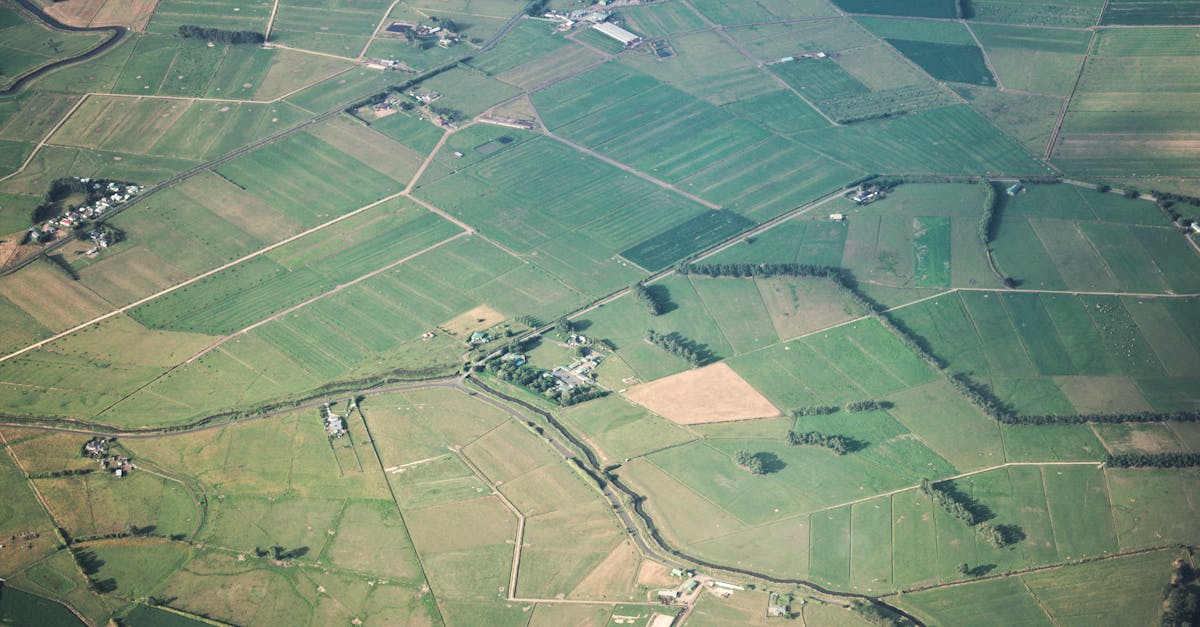
Accessibility and Site Conditions
3D laser scanning excels in challenging environments where traditional surveying methods may struggle. Uneven terrain, dense vegetation, or hazardous locations can restrict access for conventional surveying equipment and personnel. With laser scanners, operators can capture detailed data from a safe distance and in difficult conditions, minimising safety risks associated with physical site inspections. Additionally, portable laser scanners can be transported easily to remote or inaccessible locations, facilitating data collection without the need for extensive site preparation.
Traditional surveying techniques often rely on physical presence at the site, which can raise concerns in delicate environments, such as archaeological sites or protected natural areas. In these cases, the impact of foot traffic can be detrimental, potentially damaging sensitive artifacts or ecosystems. 3D laser scanning allows for thorough documentation with minimal disruption to the environment, making it an ideal choice for sensitive projects. The capability to capture expansive areas quickly and accurately mitigates the limitations imposed by site conditions, ultimately enhancing data quality and project efficiency.
Challenges Faced in Various Environments
Different environments present unique obstacles for both 3D laser scanning and traditional surveying methods. In dense urban areas, access to sites may be restricted by buildings, traffic, and other infrastructure. Surveyors may struggle to obtain accurate readings in these settings due to obstructions and the need for careful navigation around urban infrastructure. Furthermore, variable weather conditions can impact the efficacy of traditional methods, making it difficult to gather reliable data during rain or high winds.
Rural areas also pose specific challenges, particularly concerning accessibility. Rough terrain, such as steep slopes or heavily vegetated landscapes, complicates the use of conventional surveying tools and can require significant physical effort. Similarly, while 3D laser scanning technology is recognised for its speed and efficiency, it can face limitations in locations with limited visibility or excessive foliage. These environmental factors necessitate a careful consideration of the chosen method for accurate and reliable data collection in both urban and rural contexts.
Data Processing and Output
The processing of data in 3D laser scanning often involves sophisticated software designed to handle large datasets. Point clouds generated from laser scans require considerable computational power and expertise to manage effectively. Advanced algorithms can convert raw laser data into detailed 3D models, allowing for precise measurements and analyses. Techniques such as filtering, classification, and surface modelling facilitate the extraction of useful information, making the outputs highly relevant for various applications.
In contrast, traditional surveying methods typically produce less complex data outputs. Measurements recorded with theodolites and total stations tend to be manually processed, which can lead to potential human error during calculations or data entry. Software programs for traditional surveying are commonly more straightforward, focusing primarily on 2D representations. While they can adequately serve many purposes, they may not capture the intricate details that modern 3D laser scanning can provide, potentially limiting the depth of analysis in complex projects.
Software Utilisation in Each Technique
3D laser scanning relies heavily on sophisticated software to process vast amounts of data collected during surveying. The software integrates point cloud data to create accurate 3D models, facilitating visualisations that traditional methods cannot achieve. Programs specifically tailored for 3D scanning allow users to manipulate and refine the data, enhancing accuracy while reducing processing time. Features such as automated feature extraction can further streamline workflows, making it easy to generate deliverables.
Conversely, traditional surveying methods typically employ software designed for basic mapping, data analysis, and drafting. Applications such as AutoCAD and GIS tools allow surveyors to input measurements and create two-dimensional representations of terrain. While effective, these tools often require more manual input and interpretation compared to their 3D scanning counterparts. The necessity for manual adjustments can lead to time-consuming processes, hindering efficiency on larger projects.
Applications in Different Industries
The versatility of 3D laser scanning makes it an invaluable tool across various sectors. In construction, it allows for precise measurements and the generation of accurate as-built drawings. This technology facilitates seamless integration with Building Information Modelling (BIM), enhancing project coordination and efficiency. In the field of heritage preservation, 3D laser scanning provides detailed documentation of historical sites. It captures intricate details that may be difficult to achieve through traditional methods, ensuring that valuable cultural assets are preserved for future generations.
Traditional surveying methods still hold relevance in many industries, particularly where long-standing practices are entrenched. In civil engineering, for example, topographic surveys remain crucial for mapping terrain and planning infrastructure projects. These techniques often rely on human expertise and extensive fieldwork, ensuring an understanding of site-specific conditions that can influence project outcomes. Additionally, land surveying for real estate transactions continues to rely heavily on conventional methods, as these processes necessitate legal precision and thorough verification of property boundaries. Each method, traditional or modern, serves unique roles, shaped by the specific requirements of diverse applications.
Sector-Specific Use Cases
The construction industry has embraced 3D laser scanning for its precision and speed. This technology allows for detailed site documentation and monitoring of progress, reducing errors during the building process. Architects and engineers can utilise the data to create accurate 3D models, facilitating better design decisions. In contrast, traditional surveying methods often involve extensive manual measurements, which can be time-consuming and prone to human error.
In the heritage and conservation sectors, 3D laser scanning plays a vital role in preserving historical structures. The ability to capture intricate details and create a digital archive is invaluable for restoration projects. Traditional methods might not capture the same level of detail without significant effort. Similarly, in the mining industry, these scanning techniques are applied for site analysis and volumetric calculations. The efficiency and accuracy provide a competitive advantage over conventional surveying methods that may struggle in harsh mining environments.
FAQS
What is 3D laser scanning?
3D laser scanning is a technology that captures the physical characteristics of a space by using laser beams to create highly detailed three-dimensional models of the environment.
How does 3D laser scanning compare to traditional surveying methods?
3D laser scanning typically offers faster data collection, higher accuracy, and the ability to capture complex geometries compared to traditional surveying methods, which may be more time-consuming and less precise.
What are the accessibility challenges faced in different environments?
Accessibility challenges can vary widely; for instance, traditional surveying may struggle in rugged or hazardous terrains, while 3D laser scanning can adapt to difficult conditions but may require careful setup and calibration.
Which software is commonly used in 3D laser scanning?
Common software for 3D laser scanning includes Autodesk ReCap, Faro Scene, and Leica Cyclone, which are designed to process and visualise the data collected from laser scans.
What industries benefit the most from 3D laser scanning?
Industries such as construction, architecture, heritage conservation, and mining benefit significantly from 3D laser scanning for its efficiency and accuracy in capturing detailed site information.
Related Links
How 3D Laser Scanning Enhances Land Surveying EfficiencyCase Studies: Successful Implementations of 3D Laser Scanning
Cost-Benefit Analysis of Adopting 3D Laser Scanning in Surveys
Training and Skills Required for Effective 3D Laser Scanning
Integration of 3D Laser Scanning with Other Surveying Technologies
The Future of 3D Laser Scanning in Australian Land Surveying